Digital Tree Map
Overview
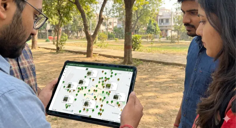
The Digital Tree Map is a pioneering citizen science initiative designed to document the urban canopy of Vallabh Vidyanagar. Using GPS technology, we are creating a comprehensive database of every tree in the town, recording species diversity, health, and age. This open-access platform empowers citizens and planners to make data-driven decisions for urban greening.
Key Objectives
-
Map every tree in the V.V. Nagar area with precise lat-long coordinates.
-
Create an interactive public dashboard for students and researchers to study urban biodiversity.
-
Identify areas with low canopy cover for targeted plantation drives.
Conservation Impact
Over 10,000 trees mapped to date, creating a blueprint for other Indian cities to digitize their natural assets.
Project Details
Support Our Projects
Your contribution helps us continue critical field research and conservation.
Donate Now